
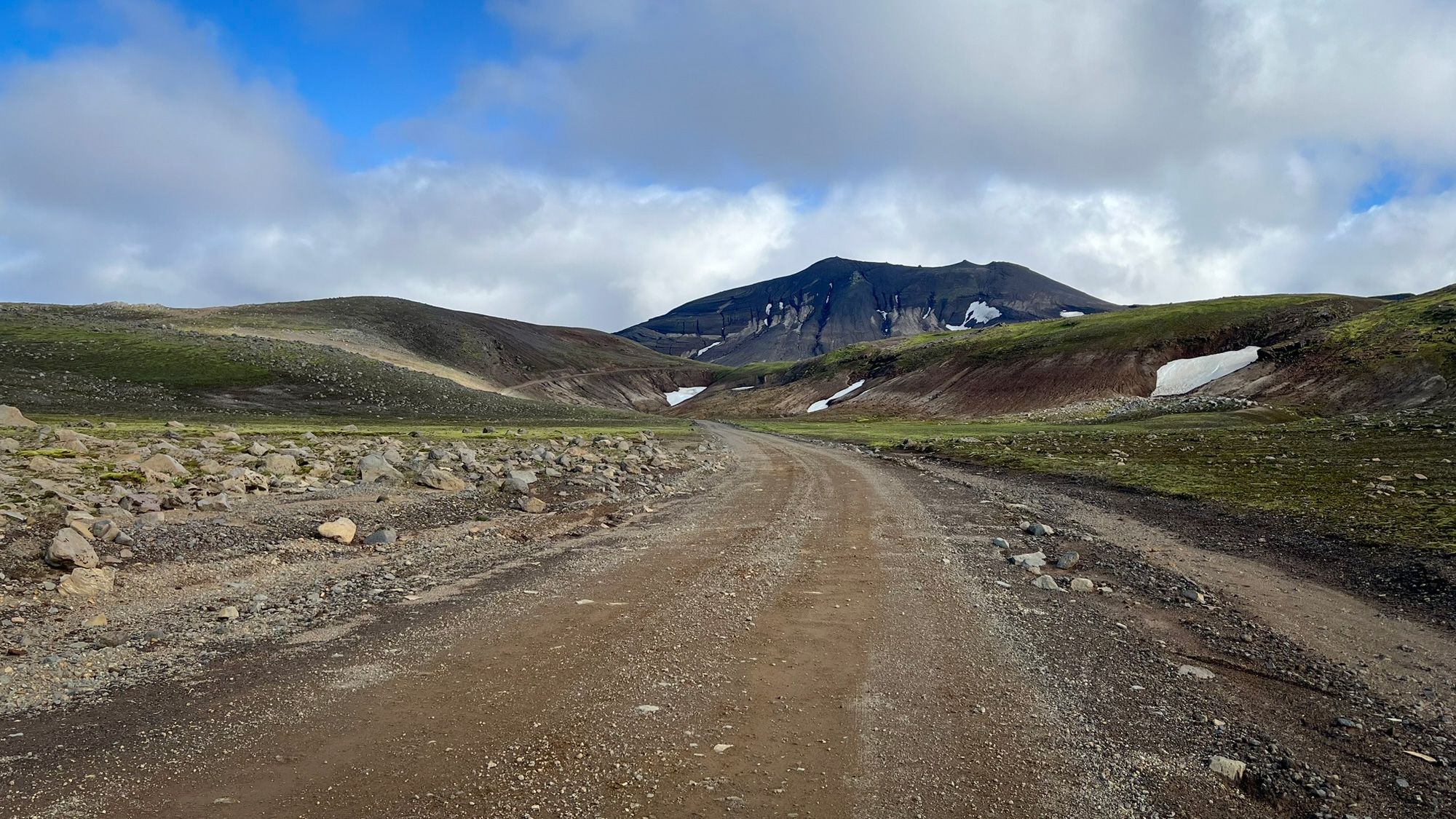
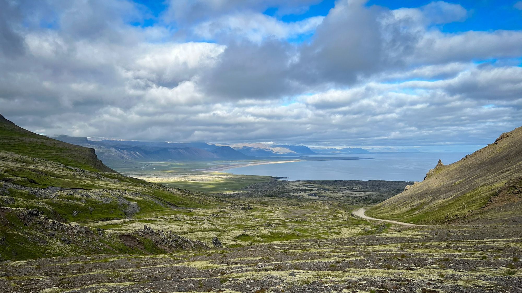
On the Snæfellsnes peninsula, there are only two roads marked with the letter F. One of them is the F570 road running through the mountains at the foot of the Snæfellsjökull glacier. It’s not particularly long and there are no river crossings. In some places, however, it becomes very steep and rocky, and even in summer it can be difficult to drive in bad weather. That’s why it stays closed for most of the year. It’s mid-May now, and the road is still impassable.
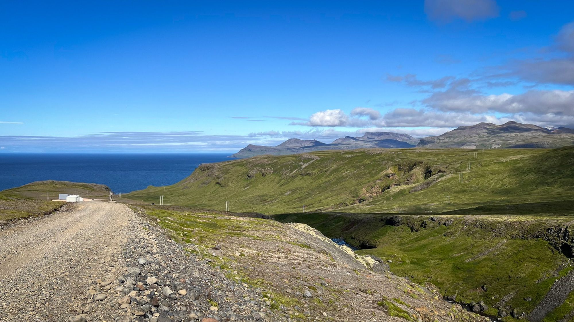
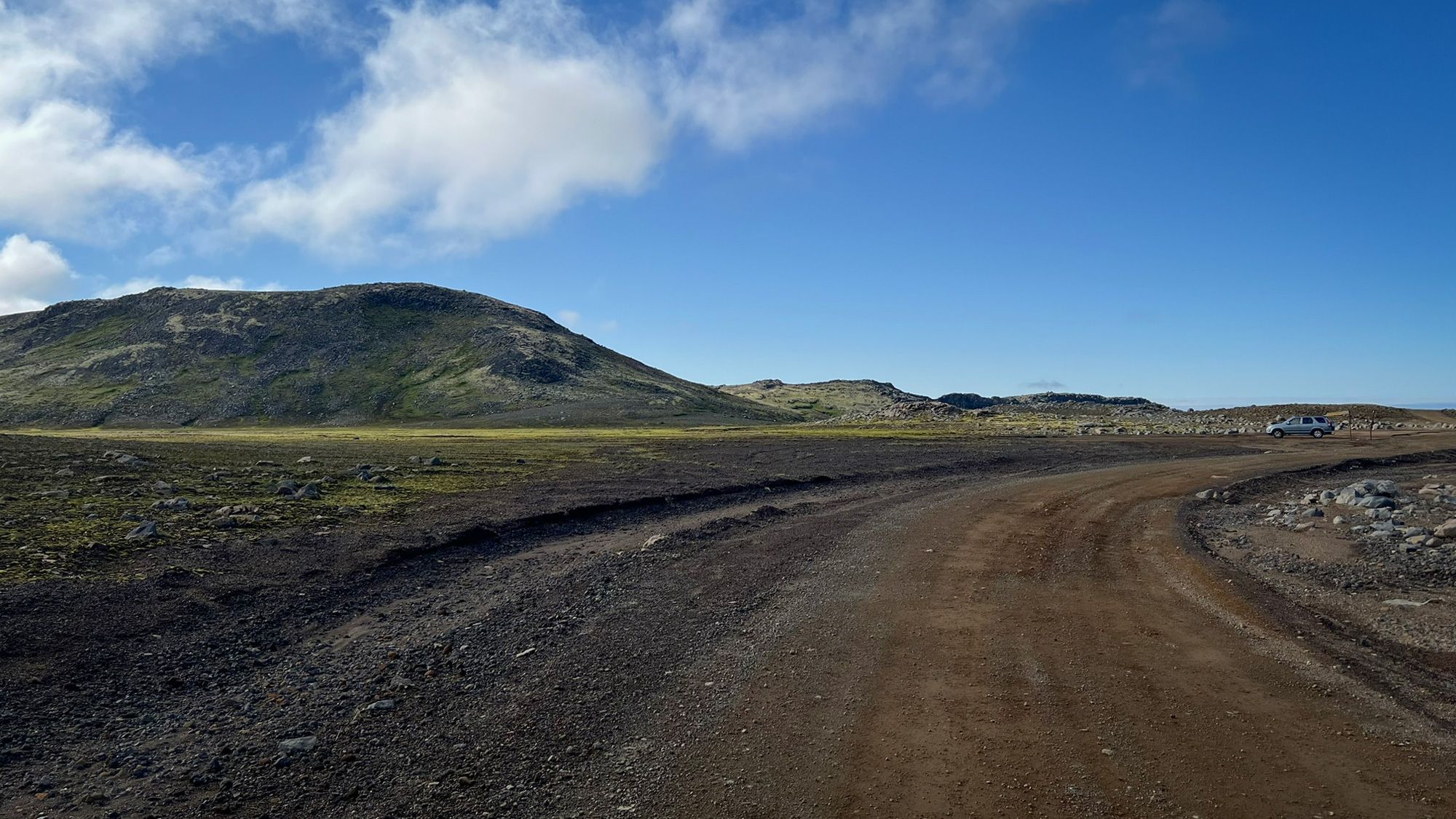
Most tourists drive around the peninsula using the main road and stopping at the best-known viewpoints. F570 leads through a completely different world. More empty, more raw, and much quieter.
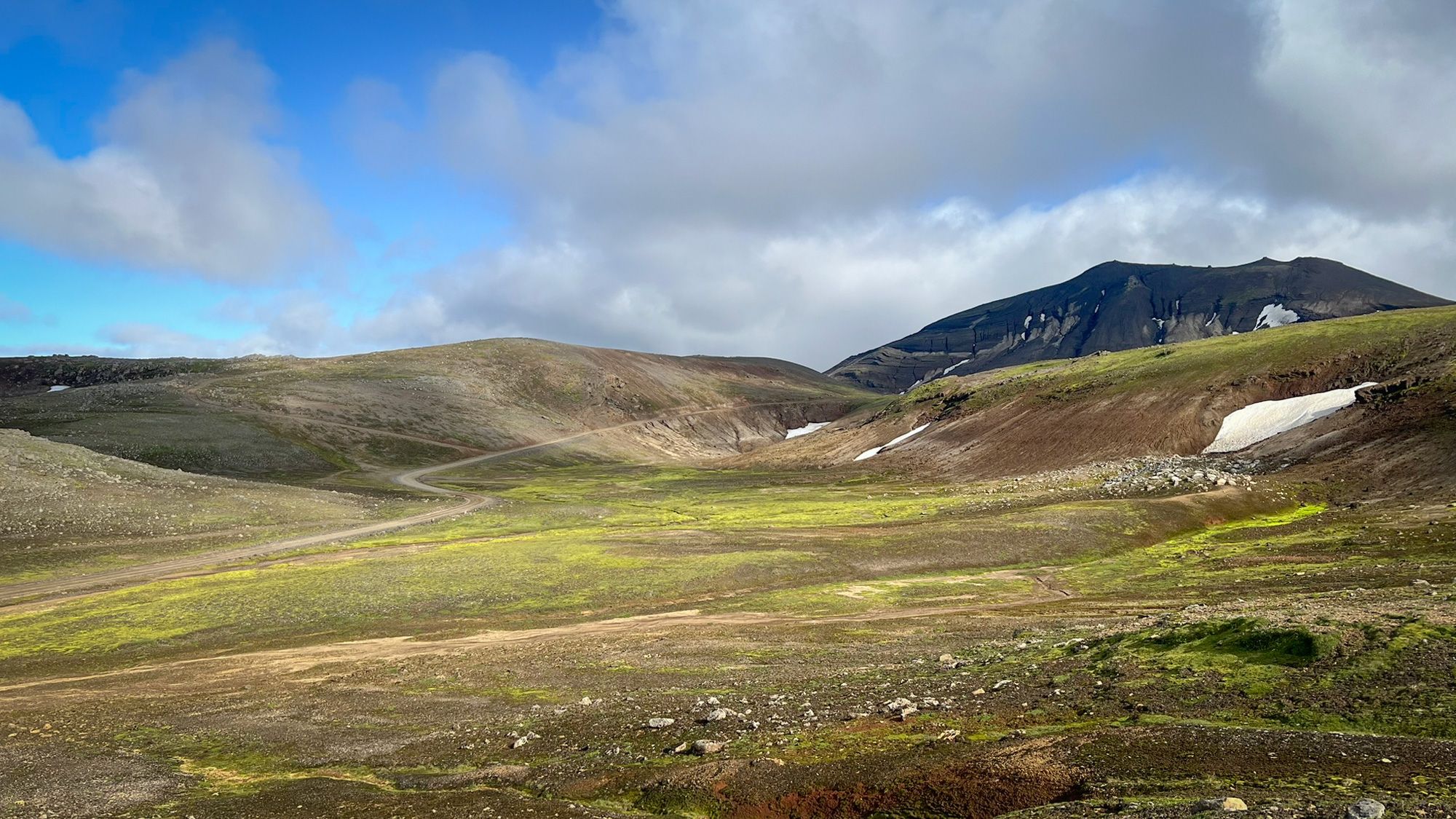
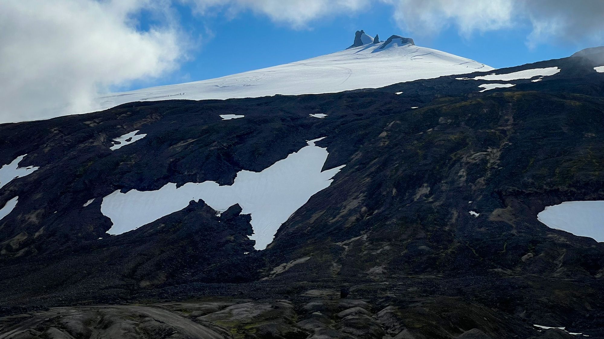
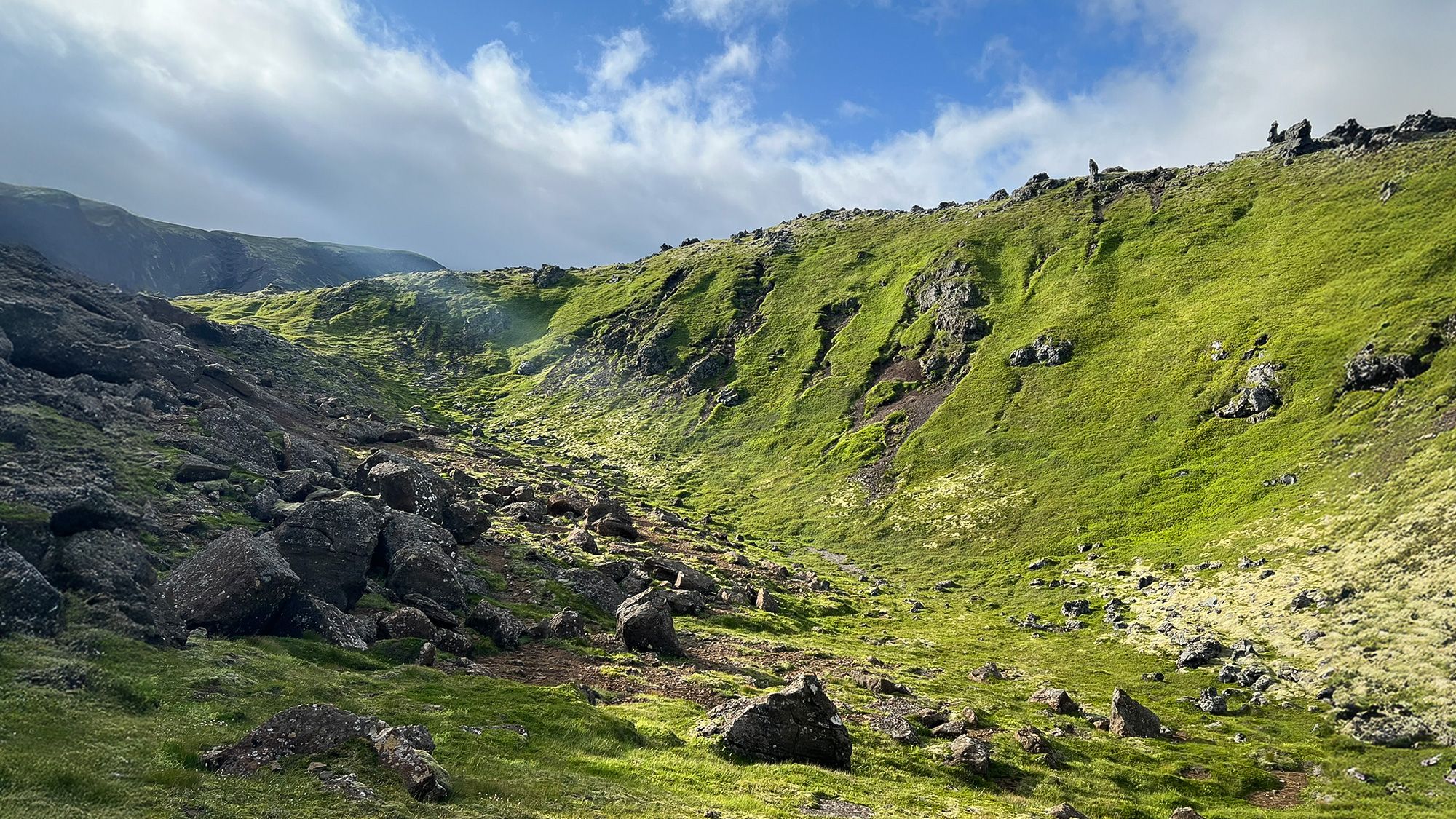
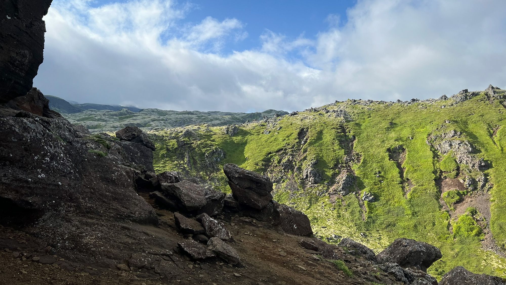
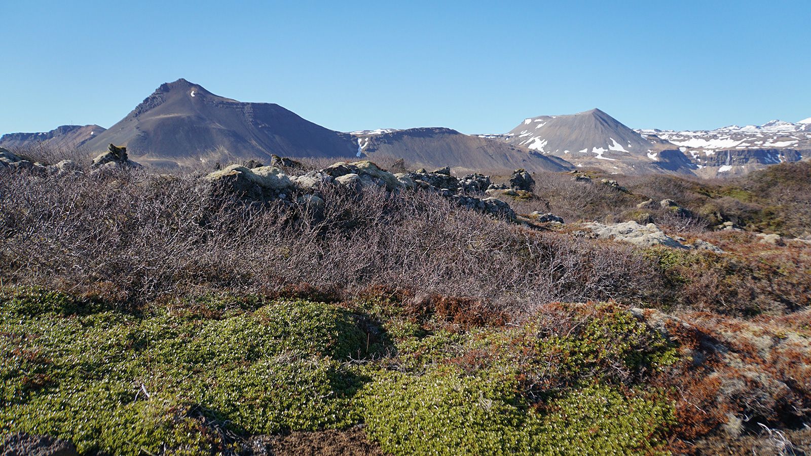
You can drive very close to the glacier. Along the way, the landscape slowly changes - from moss-covered rocky ground to almost black rocky slopes with patches of snow still lying between them even in summer.
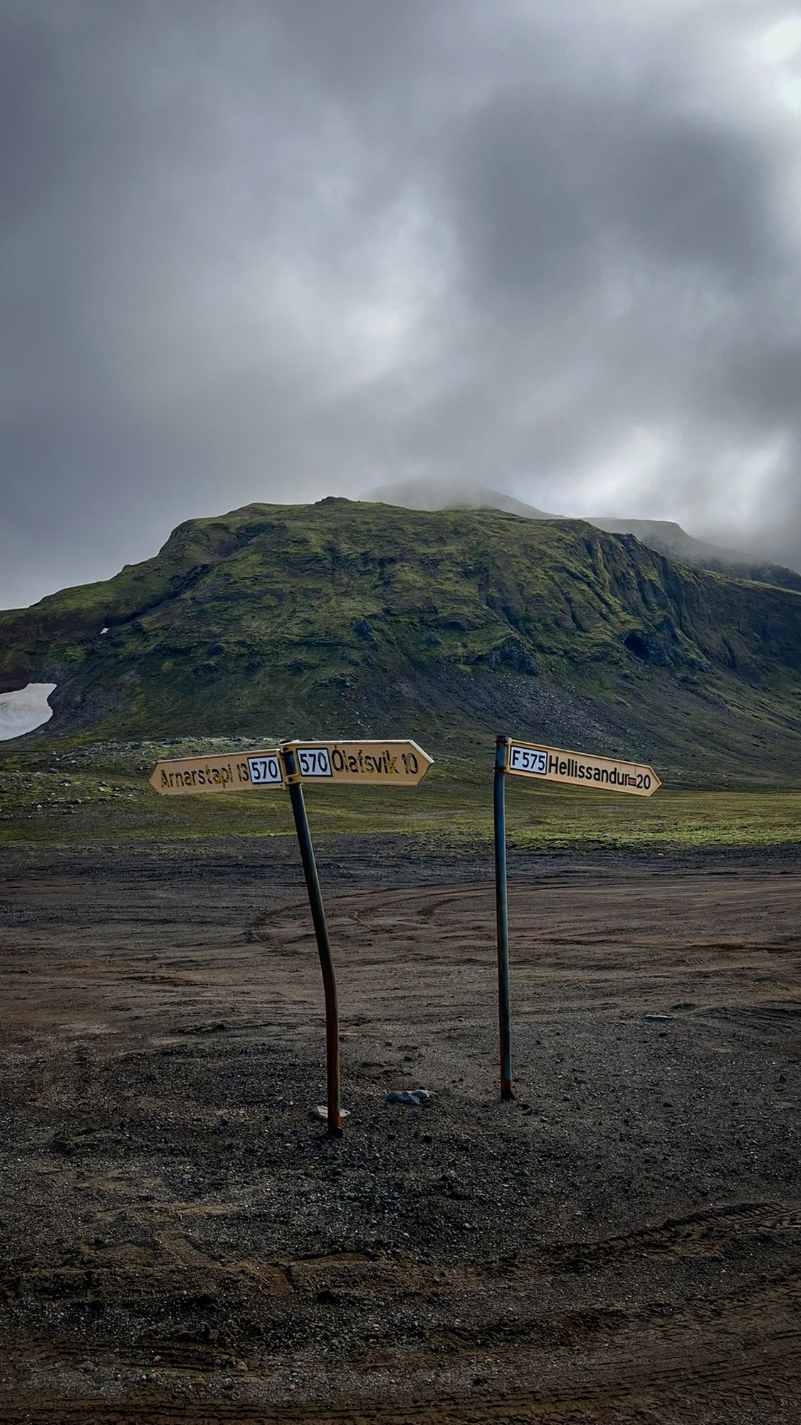
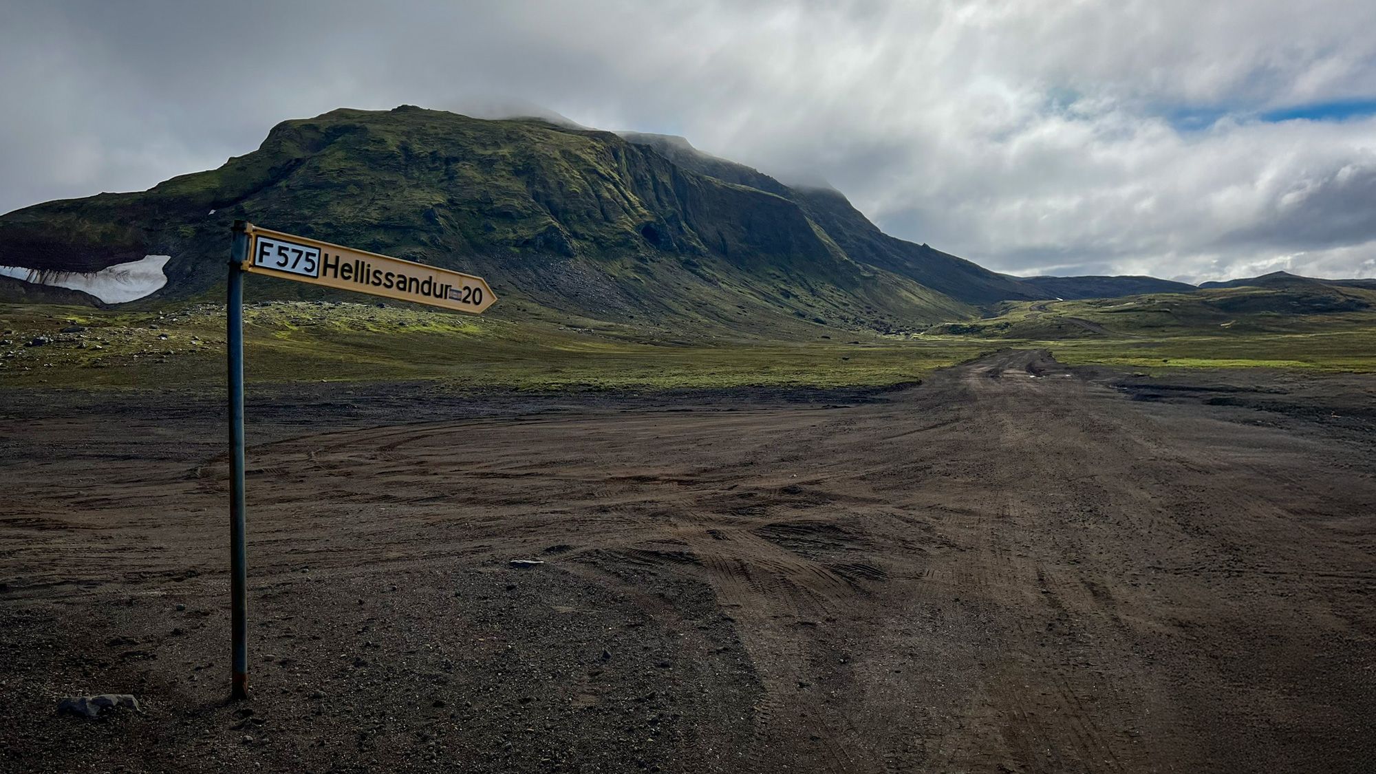
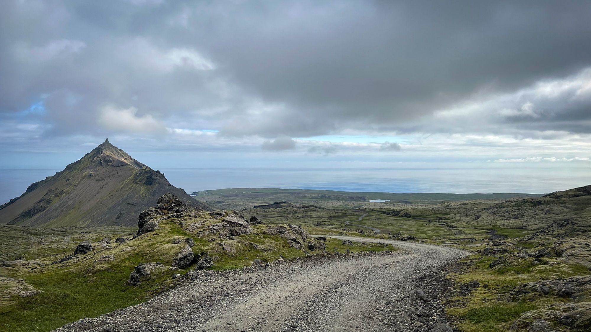
One of the places that stayed in my memory the most was the junction of roads F570 and F575. In practice, it hardly even feels like a crossroads. It looks more like a muddy, flattened patch of ground in the middle of nowhere. Just tire tracks, lonely crooked signs, and mountains all around.
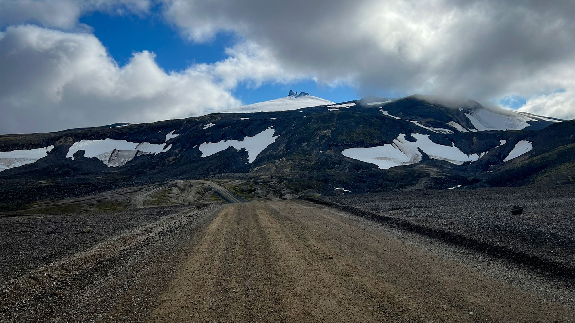
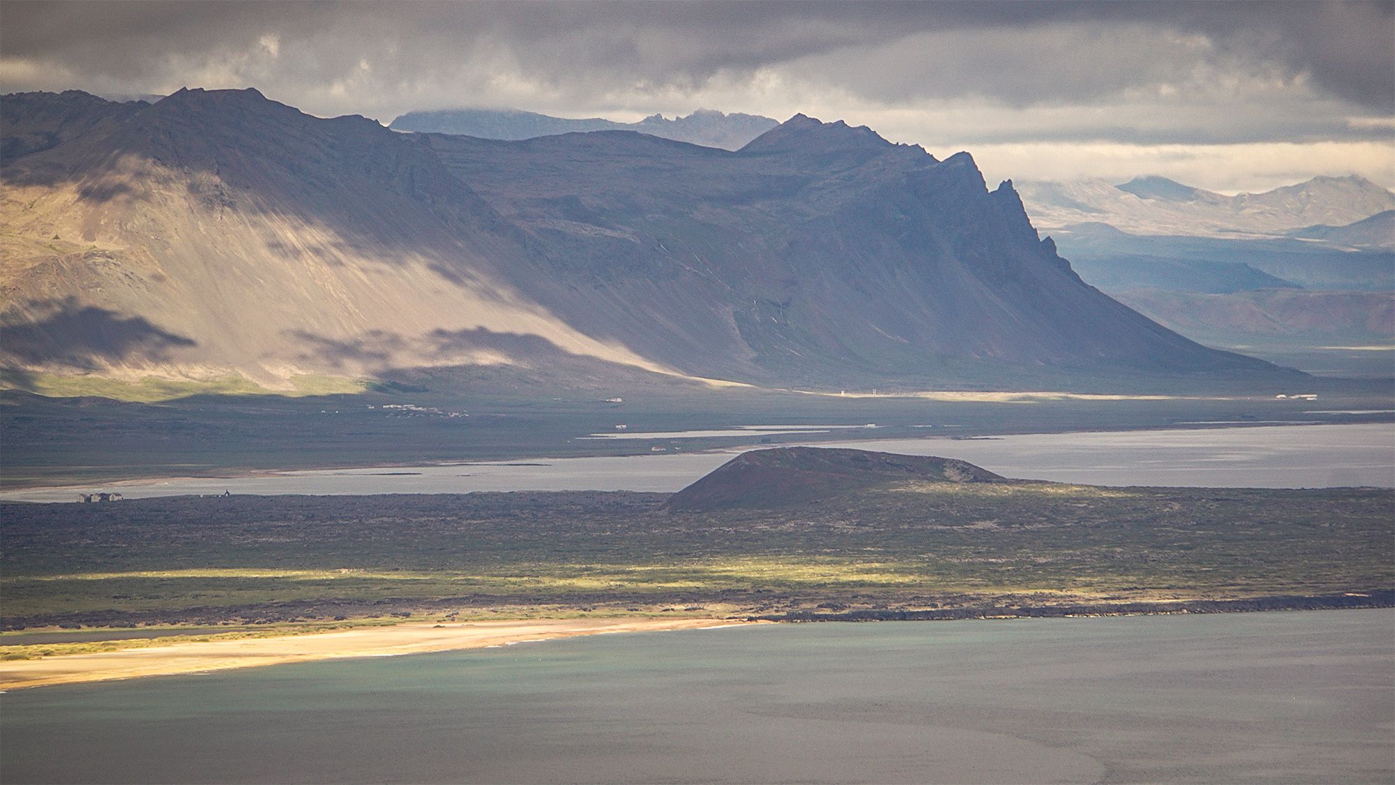
Despite the low clouds, Snæfellsjökull kept appearing between them from time to time. A glacier and at the same time a volcano dominating the peninsula. According to local sagas, this is where Bárður Snæfellsás, the guardian of Snæfellsnes, lives. It's also the same volcano that Jules Verne used as the entrance to the center of the Earth in his novel Journey to the Center of the Earth.
Every time it appeared between the clouds, it looked slightly unreal. More like a vision than an actual landscape.
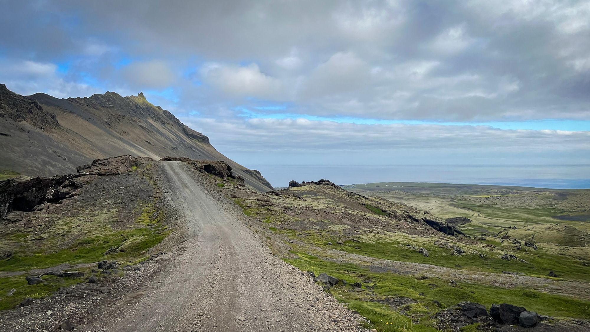
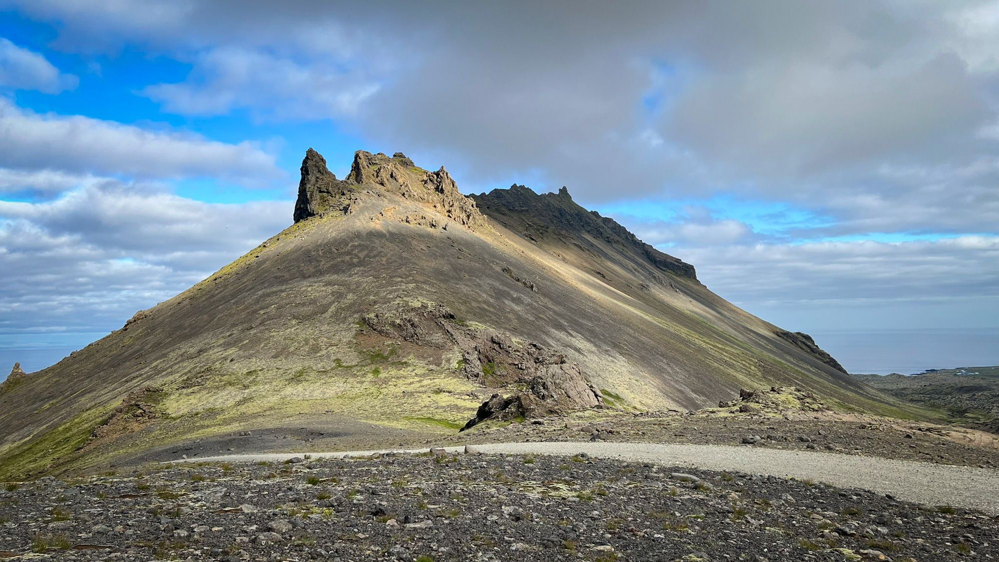
While descending toward the other side of the peninsula, my attention kept returning to Stapafell, a mountain that has fascinated me for a long time. Rocky and harsh, crowned with a stone ridge called Fellskross or Hrossfell. In the past, this place was believed to be connected with sacred powers, and according to local beliefs the mountain was home to hidden people.
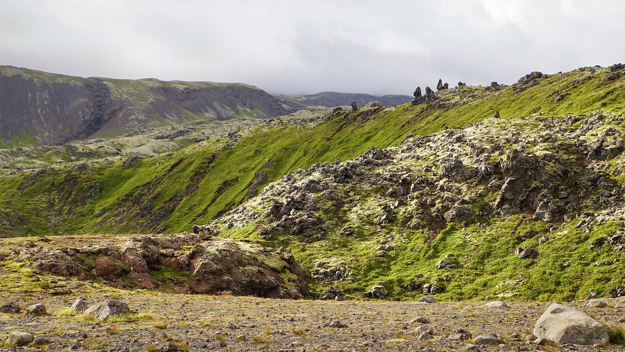
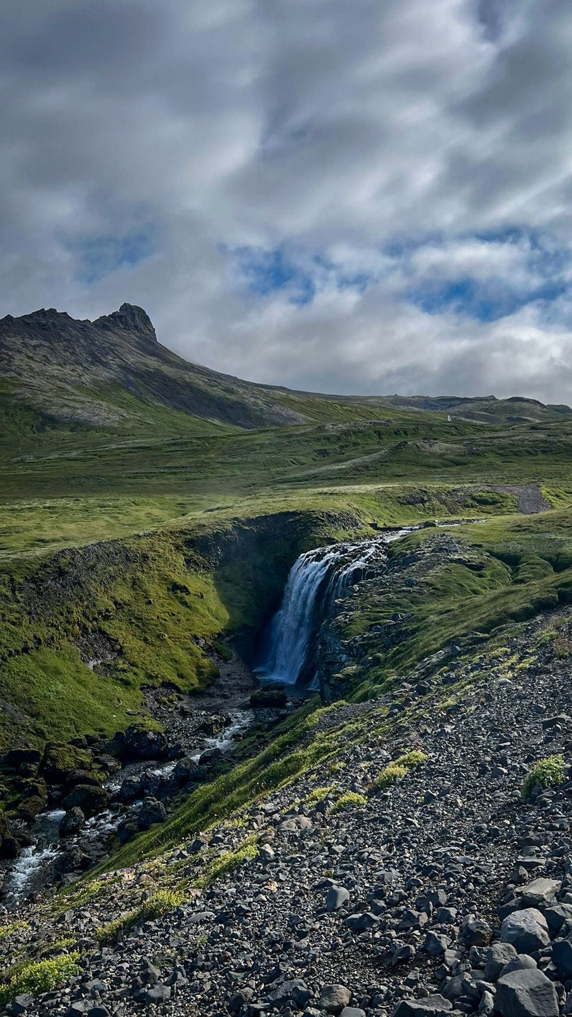
The landscape around it feels almost lunar. And yet it only takes a few steps away from the road for everything to change. Between lava fields and piles of rocks, small green corners are hidden away beneath soft moss and short grass. Sheltered from the wind, quiet, and almost cozy.
This contrast is what fascinates me here the most. From a distance, the raw mountains and rocky wastelands seem completely unwelcoming. But once you get closer, you begin to notice small valleys, rocky meanders, and places where you simply want to sit for a while and look around. You sit there in complete silence, hearing only the quietest sounds. Maybe hidden people really do move between these rocks. Who knows.
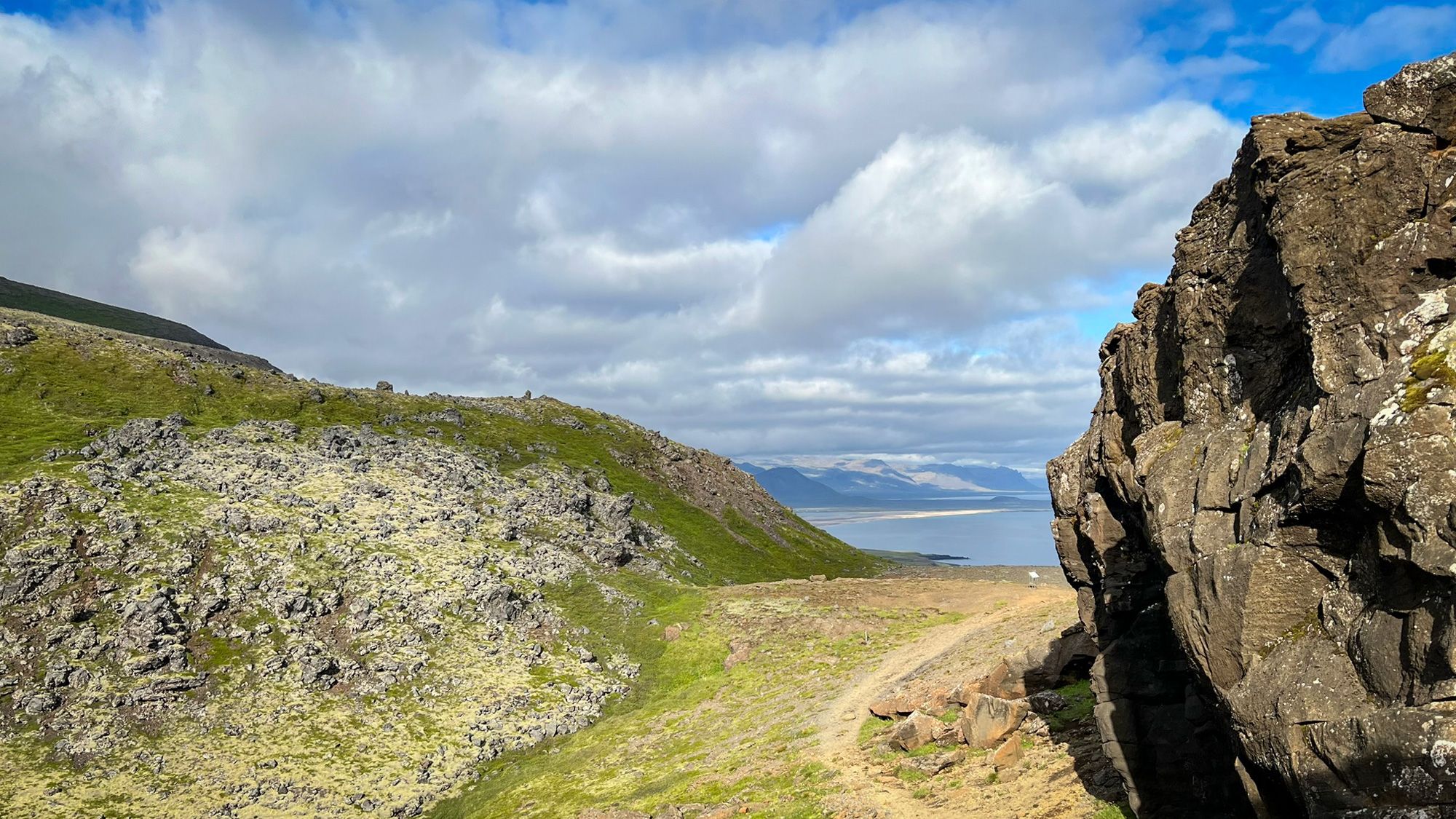
Driving down toward Arnarstapi, I kept looking at the southern coast of Snæfellsnes. From this perspective, it became even clearer how enormous parts of the peninsula had once been covered by lava.
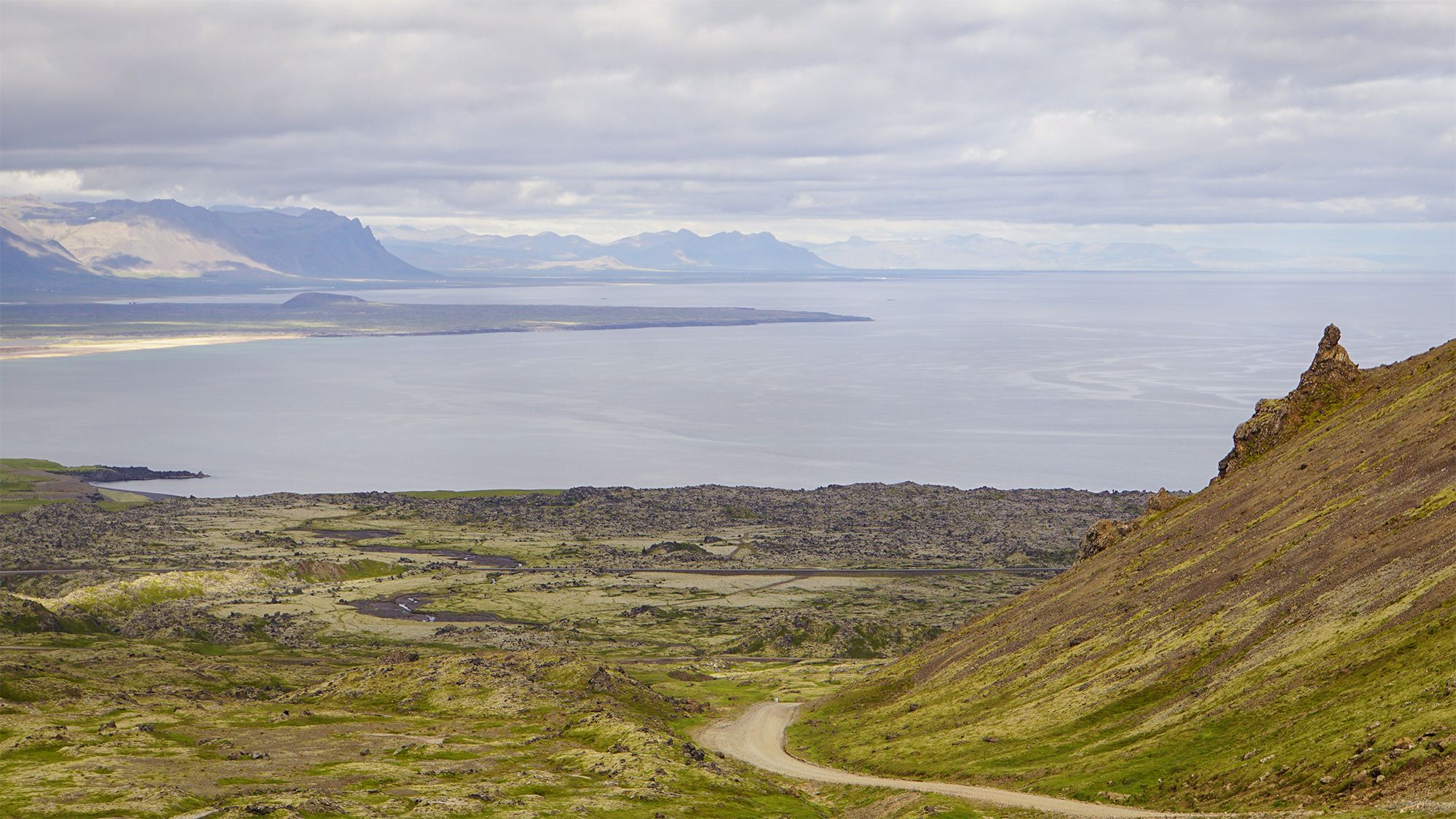
In the distance, I could even spot the area around the Búðaklettur crater, connected to the Búðahraun lava field stretching west of the black church in Búðir. A path runs there through lava and moss, and I once walked it completely alone. It was a wonderful hike. Most tourists rarely go further than a short walk around the black church itself.
Some places are worth slowing down for and exploring more deeply.
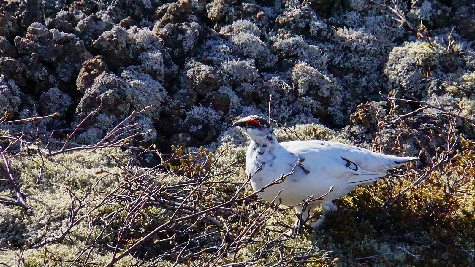
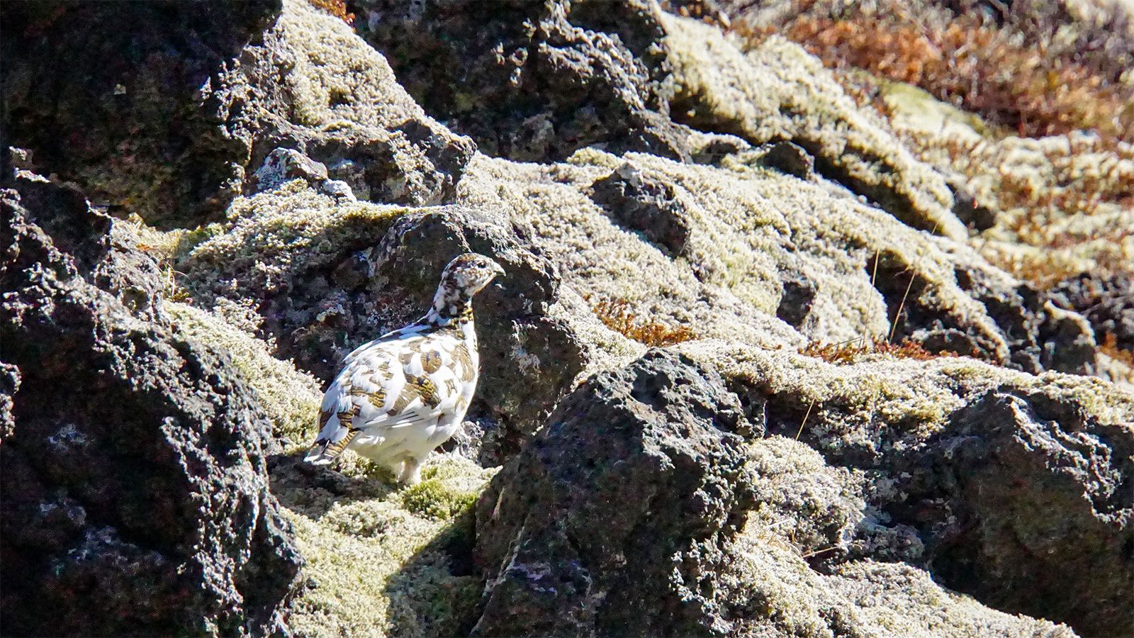
Below, you can see Búðaklettur crater, the Snæfellsjökull glacier, moss, and ptarmigans photographed during that walk. I still carry memories from that day, along with many other moments I was lucky enough to experience.

A year of transition - small trips and moving to Iceland
Where my home is - "Iceland in miniature"
Winter at my place - not as scary as they said
Chasing spring in Grundarfjörður
Wolf Beans: purple beauty or invasive species? A trip to Ingjaldshóll
Welcome to Mars: Kerlingarfjöll Mountains
Katla's tongue – Sólheimajökull Glacier
In the shadow of the glacier: the stunning Þakgil campsite
Moss and ice: the road east
Basalt and turquoise: Stuðlagil Canyon, East Iceland
Cracked earth - driving to Stykkishólmur
Off the beaten path: Hafrahvammagljúfur Canyon and the hot spring shower
The road to Mývatn: through rain and wilderness
Around Lake Mývatn (1) - Víti Crater and the Hverir geothermal field
Around Lake Mývatn (2) - the monochrome world of Hverfjall
Around Lake Mývatn (3) - Leirhnjúkur: a walk on warm ground
On the way home - Goðafoss, the waterfall of the gods
North Iceland - a small harbor and a basalt coast: Hauganes and Kálfshamarsvík
West Iceland - two unusual waterfalls framed in autumn gold
Beyond the postcard - a summer evening at Búðir and Arnarstapi
Around the Westfjords (1) - first impressions
Around the Westfjords (2) - Dynjandi Waterfall
Around the Westfjords (3) - on the way to Norðurfjörður
Around the Westfjords (4) - secrets of Kistuvogur cove
Around the Westfjords (5) - where the road ends
Waiting for Summer: along the lupine road
Sheep paths of Snæfellsnes
