 California, United States

Yes, Borrego Springs, the Salton Sea and Salvation Mountain fit into one day, and they line up well if you drive them in that order. County Route S22 runs from the middle of Borrego Springs down to the west shore of the Salton Sea. Salvation Mountain sits on the far side of the water, outside Niland. No road crosses the sea, so the only real decision is which end you go round, and the north end wins because it takes you past the state recreation area and Bombay Beach on the way.
This guide is built from three trip reports that TravelFeed writer @koenau filed from a single 2019 desert loop: the steel sculptures of Borrego Springs, Bombay Beach and Salvation Mountain. The road and season details come from California State Parks. The trip reports are seven years old now, so read them for what each place feels like on the ground, not for this year's opening times.
The route at a glance
From Borrego Springs, follow S22 east. The road has several names along the way: it runs through town as Palm Canyon Drive, goes round Christmas Circle, turns north onto Peg Leg Road and then east onto Borrego Salton Sea Way, and it ends at State Route 86 in Salton City, on the sea's western shore. Past Peg Leg Road, the route crosses into Imperial County and runs back through Anza-Borrego Desert State Park before it reaches the water.
From Salton City, head north on SR 86 to where it meets State Route 111, then turn south on 111. California State Parks puts the entrance to the Salton Sea State Recreation Area visitor center about 12 miles south on Highway 111 from the Highway 86 junction. SR 111 then follows the eastern shore for nearly 40 miles, past Bombay Beach, before it reaches Niland. Salvation Mountain is just outside Niland, at the entrance to Slab City.
You can also go round the south end, through Brawley and north on 111 through Calipatria to Niland. That gets you to Salvation Mountain without passing Bombay Beach or the recreation area, so it only makes sense if those two don't interest you.
Don't treat it as a drive with gas stations and lunch stops every few miles. A long stretch of it has neither. Bring food and water from Borrego Springs.
Borrego Springs: start with the steel sculptures
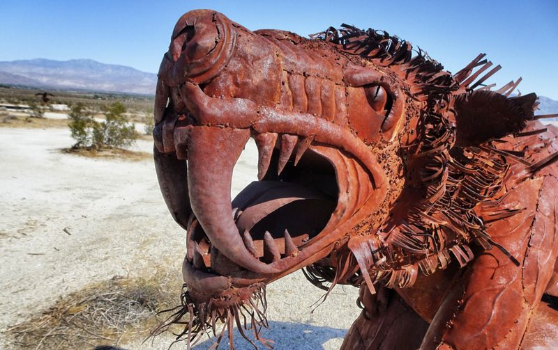
The morning belongs to the metal animals. More than 130 large sculptures by Ricardo Breceda stand on Galleta Meadows Estate around Borrego Springs. @koenau's report covers how they got there. Dennis Avery, who owned the land, wanted something for travelers to look at. He saw Breceda's work in Perris, California, and commissioned extinct desert animals first. When those ran out, he moved on to mythical creatures, horses, snakes and eagles. After Avery died in 2012, a fund he had set up paid for Breceda to maintain the pieces.
The useful part for planning is the layout. The sculptures are grouped in two areas, one north and one south of Palm Canyon Drive, the town's main street. The northern group has the bigger pieces: elephants, raptors, mammoths and sloths. Most are easy to see from the road, but as @koenau found, some sit a little way off it and need a short drive on dirt to reach. The same report advises doing the northern group early, before other visitors fill your photos.
Get a sculpture map before you set out. @koenau lists the Anza-Borrego Desert State Park visitor center as one place to pick one up, along with the Borrego Springs library and the park's support organizations. DesertUSA reports that some pieces have been moved to new spots over the years, so a current map is worth more than any older blog post's directions, this one's sources included.
The visitor center itself is at 200 Palm Canyon Drive, at the west end of the street, in a building that is mostly underground. From October 1 to May 31 it opens every day from 9 a.m. to 5 p.m. From June through September it opens on weekends and holidays only. Parking in the visitor center lot costs $10, according to the Anza-Borrego Desert State Park page.
If you are coming down from the mountains to the west, County Route S3 drops into the valley and ends at Christmas Circle, where it meets S22. Some people make a weekend of it and sleep up in Julian first. @twirble's weekend in Julian covers the town itself: apple pie, the Lilac Festival at Fort Cross, and a late lunch by Lake Cuyamaca.
S22 to the Salton Sea
East of Christmas Circle, S22 leaves town, goes north on Peg Leg Road and then turns east toward the water. This is the "desert road" that opens @koenau's sculpture report: no people, no cattle, no cars, and then a giant steel horse rearing up beside the asphalt.
Borrego Springs is an International Dark Sky Community, the first in California, with no stoplights and minimal outdoor lighting. If your plans put you back in town after dark, the night sky is a good reason not to rush away.
Salton Sea State Recreation Area
Once you've turned south on 111, the recreation area is the first proper stop. Its headquarters is at 100-225 State Park Road, Mecca, about 30 miles south of Indio. The visitor center is open every day from 9 a.m. to 4 p.m., except Thanksgiving and Christmas. Day use costs $7 per vehicle, or $5 for seniors 62 and over, per the Salton Sea State Recreation Area page.
The sea was created by Colorado River floodwater and has about 130 miles of shoreline, about 14 of them inside the park. Inflows have dropped, so the water level is falling and the salinity rising. Varner Harbor is closed to boats until further notice, and driving on the beach is not allowed. The visitor center is the easiest place on this route to learn why the shoreline looks the way it does before you reach Bombay Beach and see it for yourself.
Bombay Beach: what you'll find on the shore
Bombay Beach sits on the eastern shore, 223 feet below sea level. Wikipedia calls it the lowest community in the United States. It had 231 residents at the 2020 census, down from 366 in 2000.
@koenau's Bombay Beach post explains why it emptied out. The lake had been a resort, with hotels, yacht clubs and big-name performers in the 1950s and '60s. Then the water level dropped and the salt rose. The fish died. The report's description of the shore is blunt: former beaches that smell of rotting flesh from millions of dead shells, no one swimming, and mud where the water used to reach.
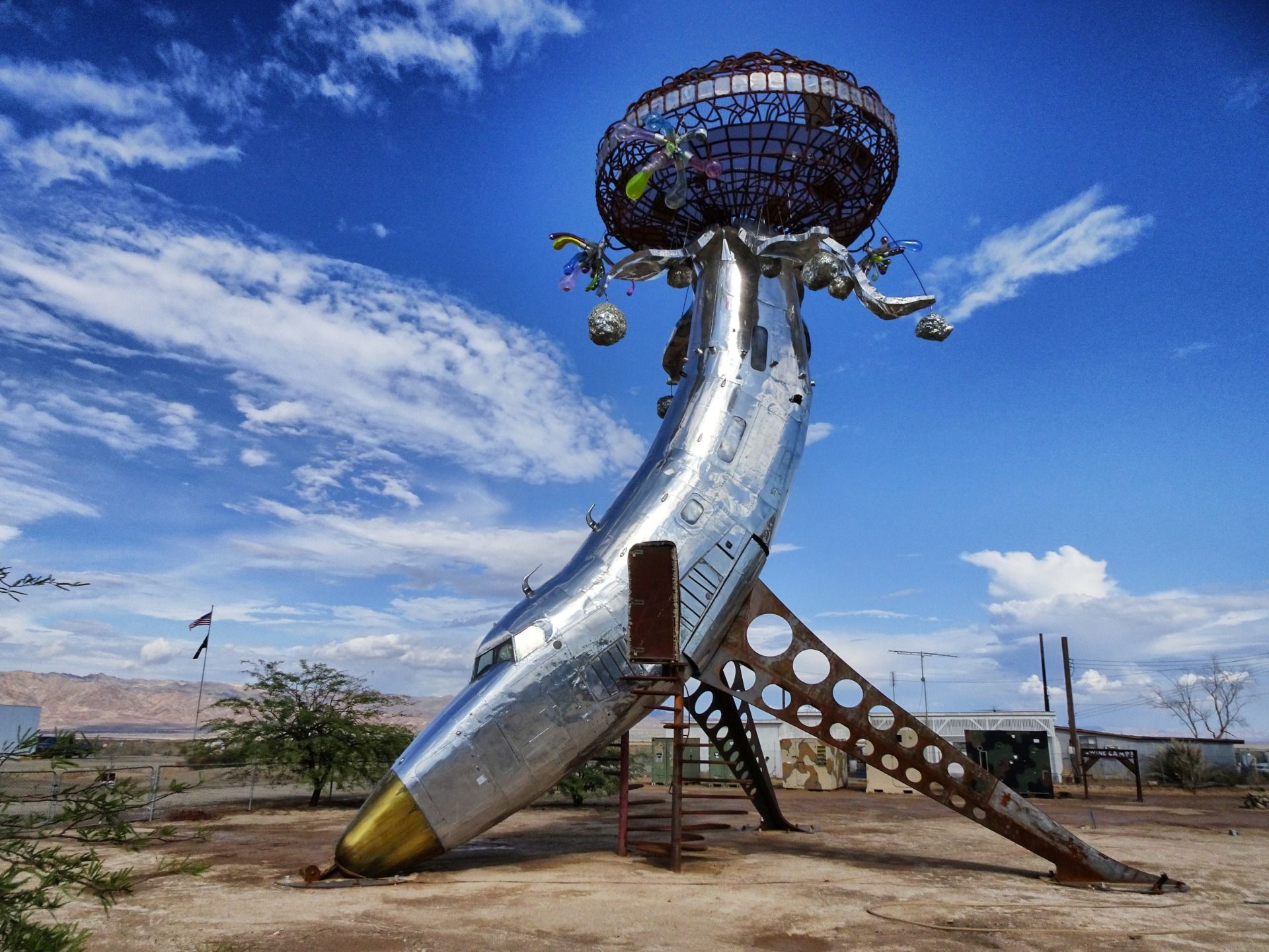
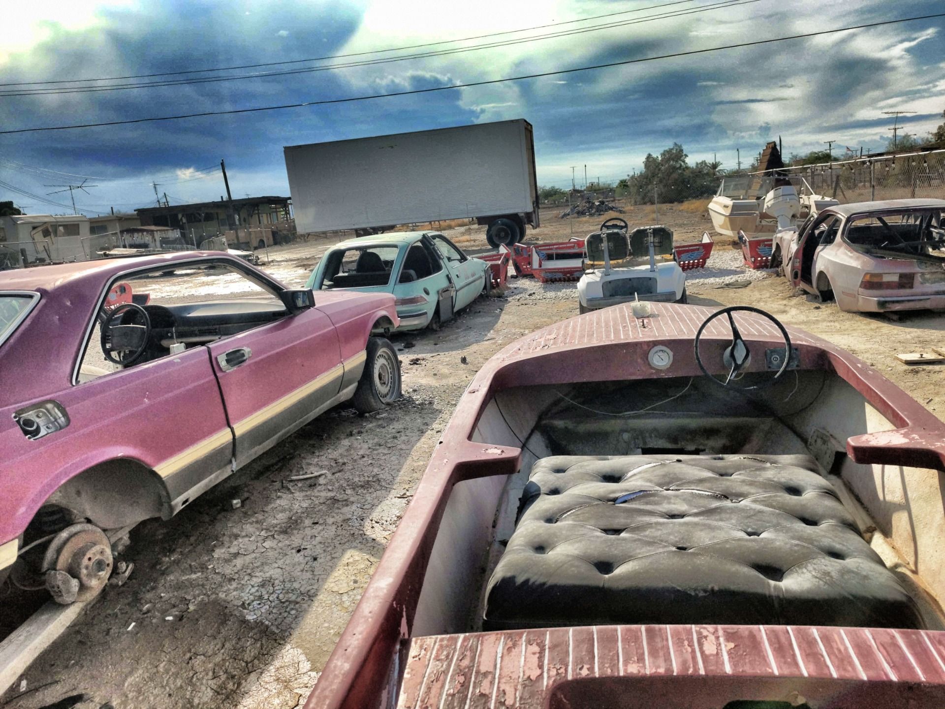
Then there's the art. Since 2016 the town has hosted the Bombay Beach Biennale, an art festival held each spring. @koenau's walk around town turned up a silver dome made of scrap metal, a slide built from twisted iron rods, two shipping containers arranged into a cross, and murals on many walls. Residents get around in golf carts. In 2019 there was a shop selling food and liquor, a bar, and a drive-in made from a dozen rusting classic cars facing a screen.
@koenau's most specific find was a neighbor's tip about photographer Ian Ruther. He had turned a whole house in town into a camera for his "Silver & Light" project and used it to make glass-plate images measuring 66 by 90 inches. One of those plates now hangs in the Nevada Museum of Art.
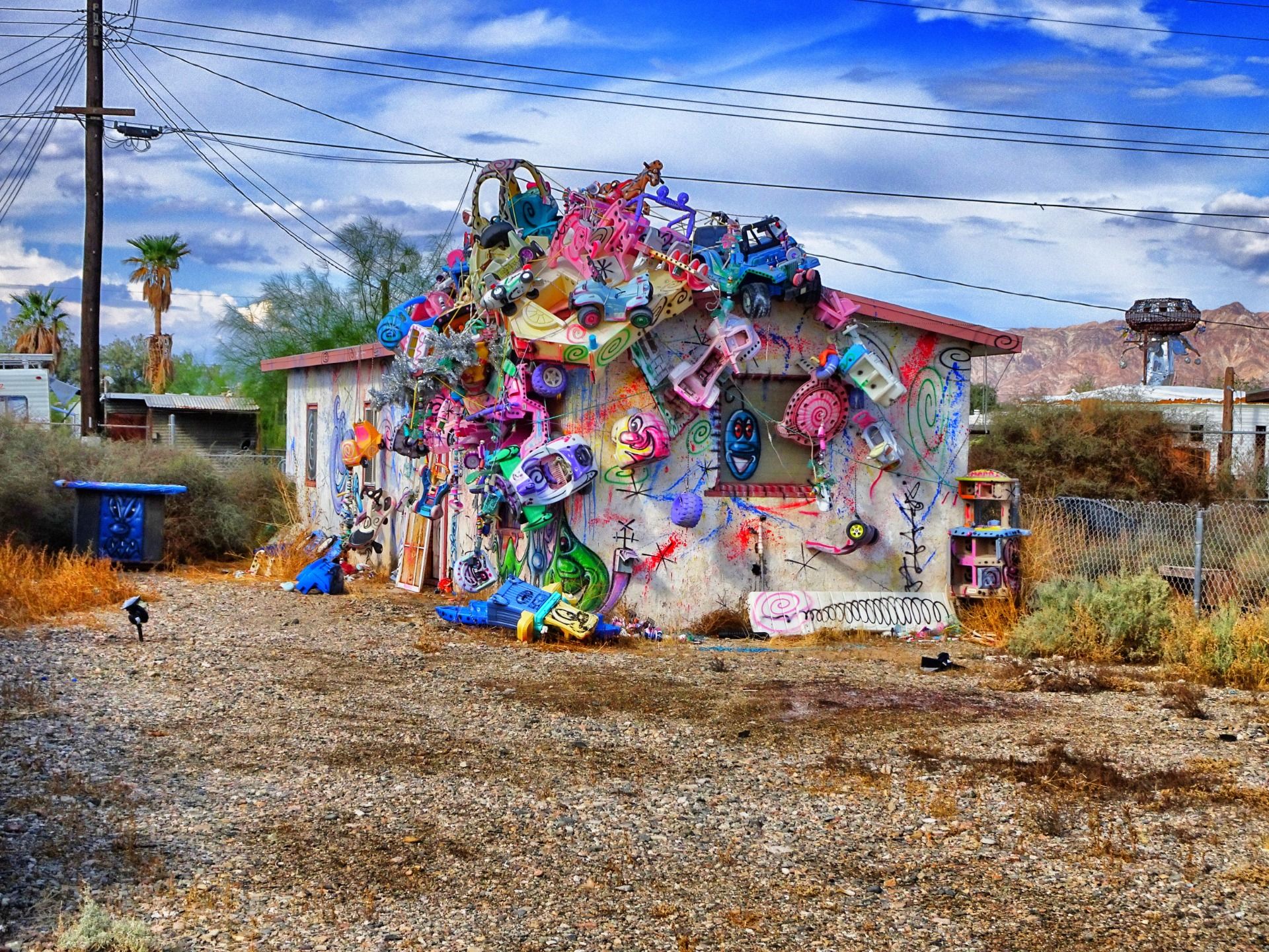
One practical warning. @koenau was told the nearest gas station was about 40 miles away. Wikipedia puts it closer, about 20 miles away in Niland. Either way, nobody should arrive in Bombay Beach on a near-empty tank.
Salvation Mountain and Slab City
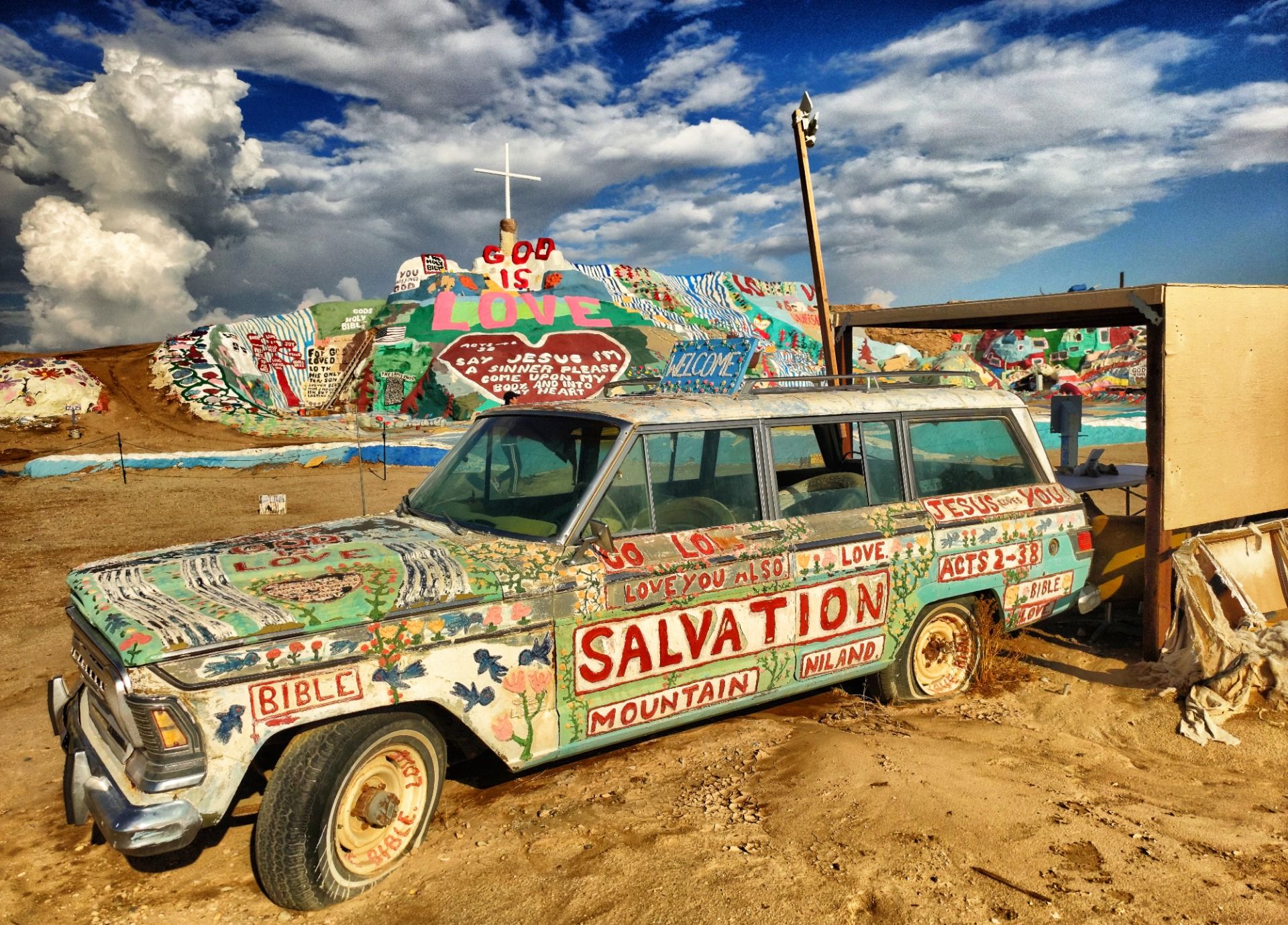
From Bombay Beach, keep south on 111 to Niland. Salvation Mountain is a painted hill northeast of the town, at the entrance to Slab City. Leonard Knight made it. He was born in 1931 near Burlington, Vermont, and he began the first version in 1984. A rainstorm cracked it in 1989 and it collapsed. The hill there now is the rebuild, made of adobe mixed with straw, discarded tires and windows, car parts and thousands of gallons of paint.
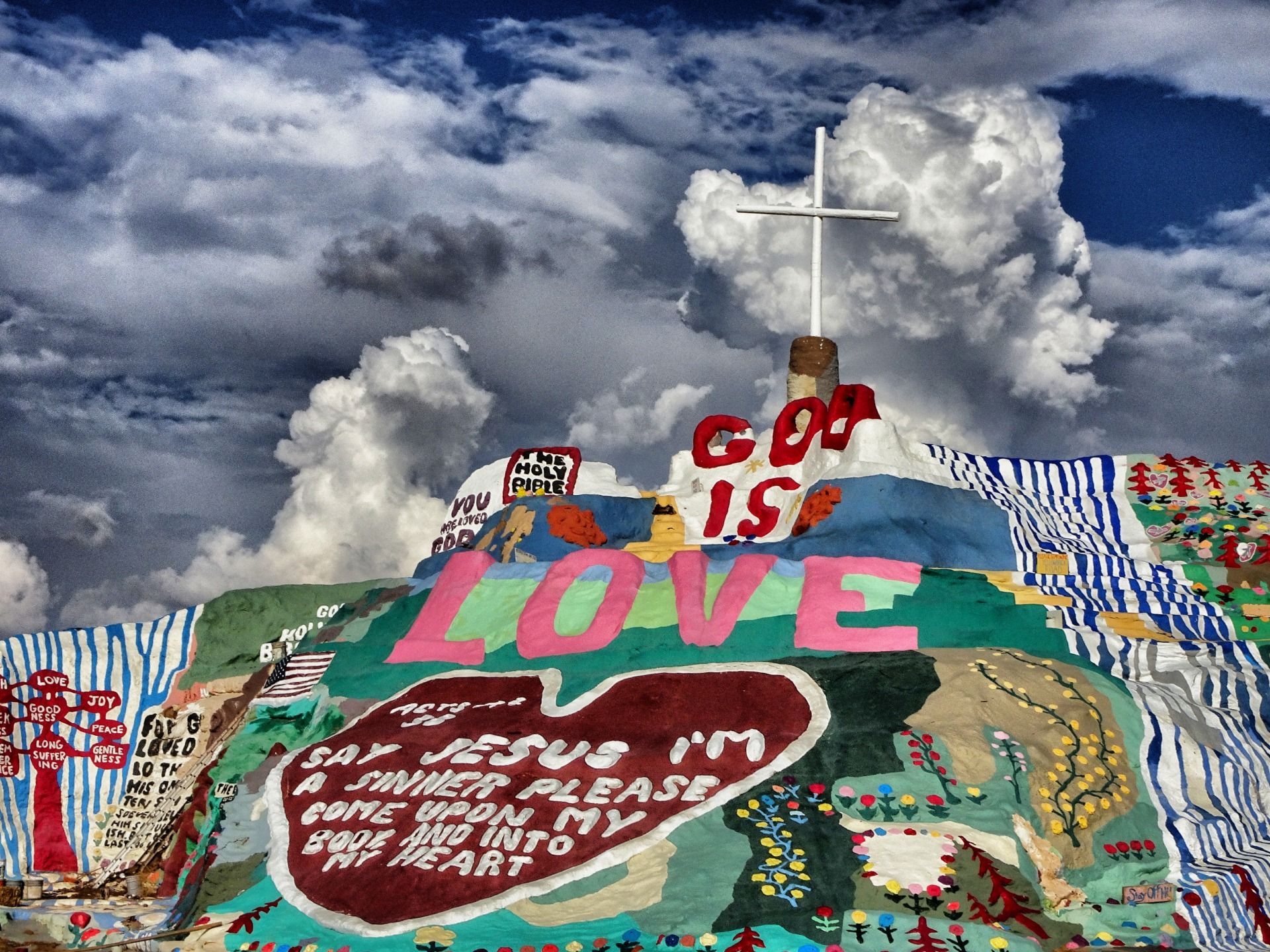
@koenau's Salvation Mountain post fills in the man behind it. Knight lived without electricity in an old Chevrolet next to his work. He kept building for about 30 years and painted more old vehicles with Bible verses. He did not want money for any of it. The visitors who came through brought paint, and Knight gave them free tours. He moved into a care facility in El Cajon in December 2011 and died there in February 2014. Since then, volunteers and a public charity, Salvation Mountain, Inc., have looked after the site.
In 2000 the Folk Art Society of America called it "a folk art site worthy of preservation and protection," and Knight appears in Sean Penn's 2007 film Into the Wild. By 2019, @koenau noted, Instagrammers had found it too.
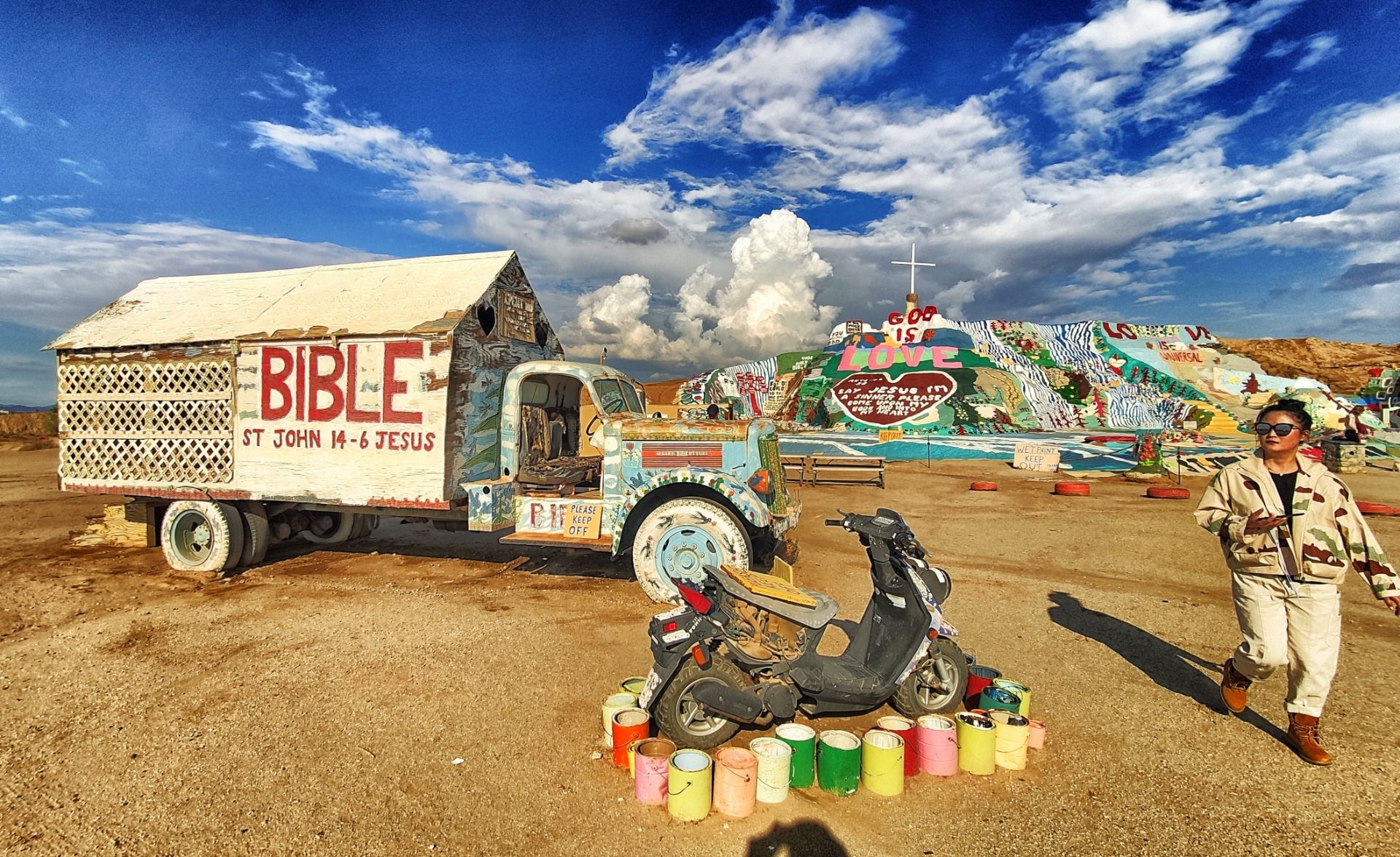
Slab City starts just past the mountain, about 4 miles northeast of Niland. It grew on the concrete slabs left behind by the Marine Corps' Camp Dunlap, whose artillery range was here from 1942. Residents run on generators or solar panels, and there are no municipal utilities. Its best-known spot is East Jesus, a lived-in art installation started in 2007.
It is a real community, not an attraction, and it has real problems. Wikipedia's account names crystal meth as the source of much of its crime. The nearest hospital is about 40 minutes away in Brawley. Visit in daylight, stay on the main roads, and don't treat people's camps as a photo set.
When to go
Go between October and May. California State Parks calls that the best season at the Salton Sea, with temperatures of 50 to 70°F. From June to September the recreation area reports temperatures of 70 to 115°F. The Anza-Borrego park page warns that summer days can reach 125 degrees and advises carrying at least one gallon of water per person per day. The visitor center drops to weekends only in summer, which says enough.
A winter weekday is the easiest choice. Spring brings the Bombay Beach Biennale, and State Parks expects Anza-Borrego's busy season to last through March and April. Plan the day so you reach Salvation Mountain with plenty of light left. The drive back from Niland goes through the same empty stretches you came through.
What to pack
- Water, at least a gallon per person, more in warm months.
- Food for the day. Don't count on stopping for lunch on the east shore.
- A full tank before you leave Borrego Springs.
- A current sculpture map from Borrego Springs.
- Paint, if you want to give something to Salvation Mountain. That is how visitors have helped it for decades.
For more trip reports from around the state, see TravelFeed's United States destination page.
FAQ
Can you see the Borrego Springs sculptures and Salvation Mountain in one day?
Yes. Do the sculptures in the morning, as @koenau recommends, take S22 to the Salton Sea, go round the north end and south on Highway 111 past Bombay Beach, and reach Salvation Mountain near Niland in the afternoon.
Which way round the Salton Sea should you drive?
Coming from Borrego Springs, go round the north end. S22 meets SR 86 at Salton City. Taking 86 north to 111 and then heading south on 111 passes the Salton Sea State Recreation Area visitor center and Bombay Beach before Niland. The southern route through Brawley skips both.
Where do you get a map of the Borrego Springs sculptures?
@koenau lists the Anza-Borrego Desert State Park visitor center at 200 Palm Canyon Drive and the Borrego Springs library as places to pick one up. Some sculptures have moved over the years, so use a current map.
Is Slab City safe to visit?
Slab City has documented problems with drug-related crime, and the nearest hospital is about 40 minutes away in Brawley. Go in daylight, stay on the main roads and respect residents' camps.
