17th Century Observatory and Church
This intriguing structure was erected in the 17th Century, combined science and religion. The Round Tower was started in 1637 and finished in 1642. The adjoining church was opened in 1656. It was my first destination after arriving in Copenhagen the day before and exploring the neighborhood near my hotel. The tower was a project of Christian IV of Denmark, at the urging of astronomer Christian Longomontanus (say that three times fast). Longomontanus sought a replacement for the famous Tycho Brahe's "Star Castle" (Stjernebor) observatory that was demolished after Brahe's 1601 death.
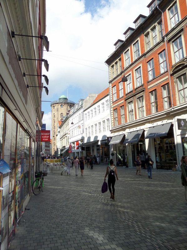
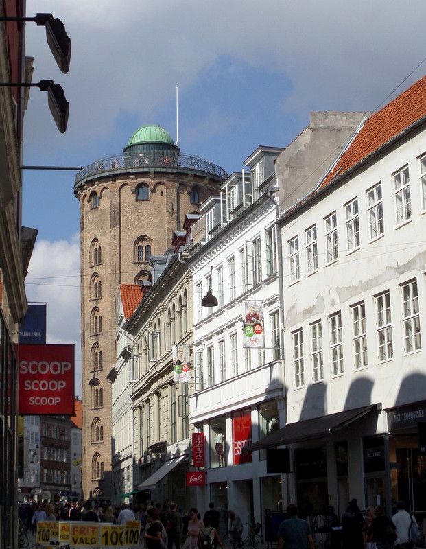
The tower is in central Copenhagen and draws the eye as you approach it on a shopping avenue. Its stout appearance belies its age and is a testament to how well it was built. Its days as an active observatory are long over, ended by urban light pollution and the vibration of city traffic, too many horses and carts in those days.
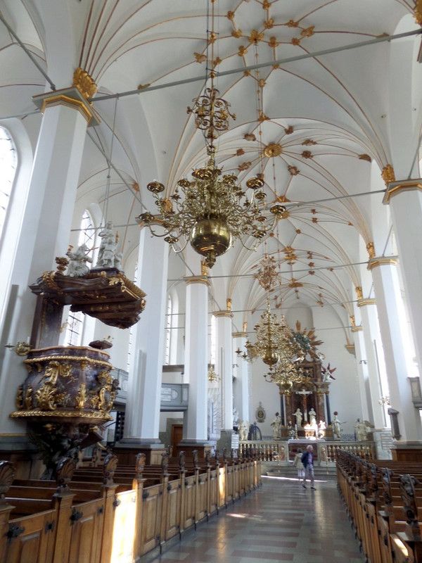
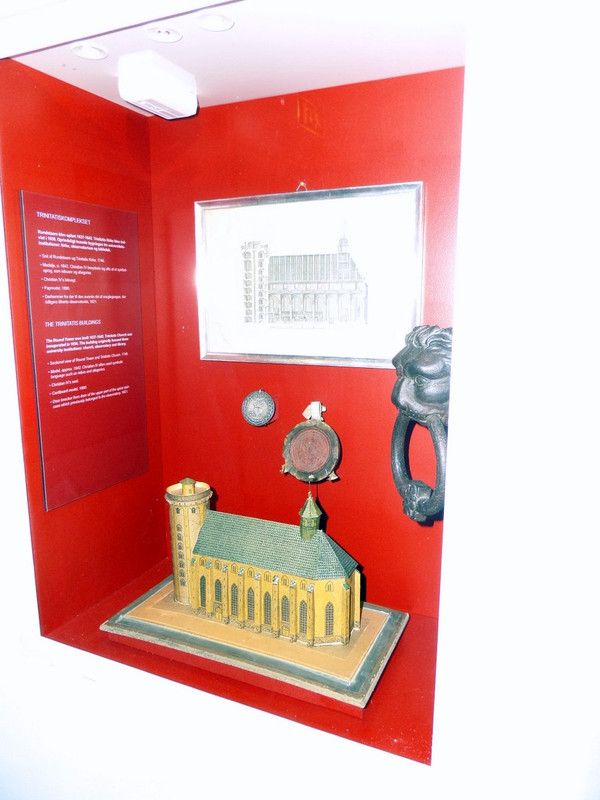
The church is quite impressive, as you can see, but is often overshadowed by its taller neighbor. I was so eager to climb the tower that I quickly moved on from the house of worship to the pillar of science.
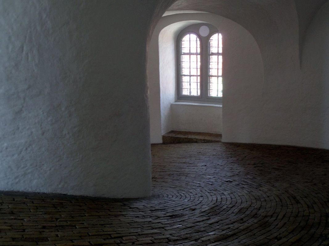
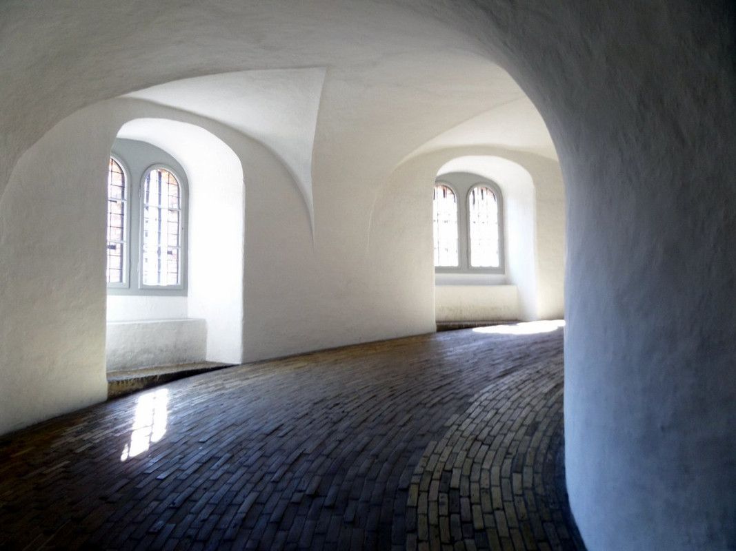
The spiral ramp that coils its way upward is paved with bricks. I tried to imagine a rider on horseback ascending the tower. Peter the Great did it, and Catherine reportedly followed him in a carriage. Did he lie on the horse's neck to avoid being brained by the lily white arches? Apparently a car once drove the ramp and bike races have been held in both directions. An electric utility cart sped by, staying close to the outside wall. Those of us walking stayed near the center to shorten the trip. Some of our way was paved with yellow bricks, like another more famous road.
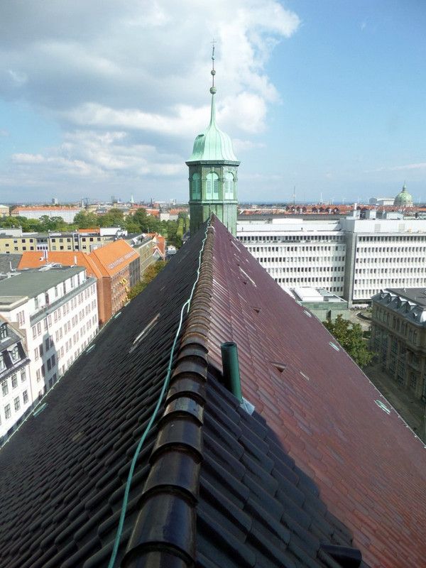
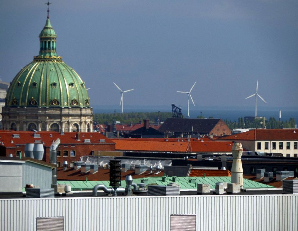
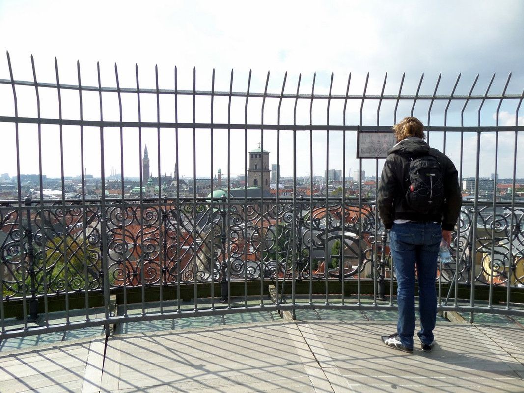
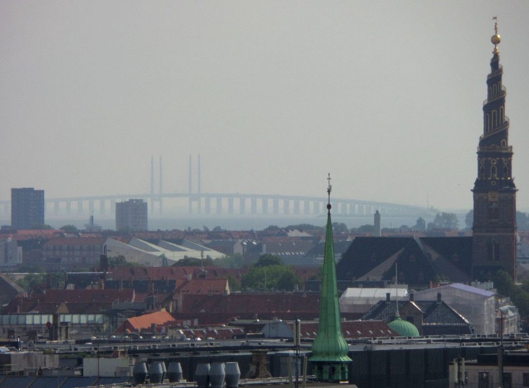
The views at the top were worth every step of the climb. The foreground was a sea of church spires, many of them with verdigris patinas earned by centuries of exposure to Danish air. In the distance were proofs of Denmark's more modern heritage. Massive white wind turbines powering Copenhagen to its goal of 100% renewable energy by 2025 and the stunning Øresund Bridge arching from Sweden to a man-made island where cars and trains disappear into an underwater tunnel. I wondered at a border so open. It reminded me of all the Danish boats in Mölle and the oh so frequent ferries between Helsingborg and Helsingør.
I compared the layout of Kobenhavn to the map on my phone and thought about where I'd go next.
Did you see my other recent Scandinavian travel posts?
Sweden
- Helsingborg - Swedish Port on the Øresund
- Swedish Ceramics Center and Food Hall
- Cattle on the Kulla and Hogs Downtown - Sweden
- Swedish Architecture
- Sailing in Southern Sweden
- Mölle Swedish Gem by the Sea
- Floating Maritime Museum in Gothenburg
- The Streets and Roofs of Gothenburg
- Viking Loot - Museum of Gothenburg
- Sweden's Second City with a Second Name
Norway & Svalbard
- A Fountain and Many Buildings in Oslo
- Oslo Photo Gallery Part 2
- Oslo Photo Gallery Part 1
- Risen Ships of the Norse - Oslo
- Winning the South Pole – Oslo
- Urban Iceberg - Oslo
- Svalbard - A Short Visit to Longyear Town
All of the content in my posts is original and the photos are Copyright © Nick Kraft.
I was traveling light. These images were taken with a small Samsung point-and-shoot camera or a smartphone!
Thank you!
Nick
